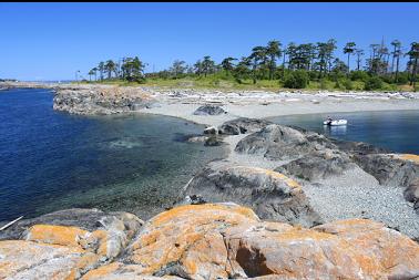
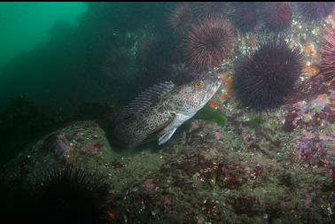
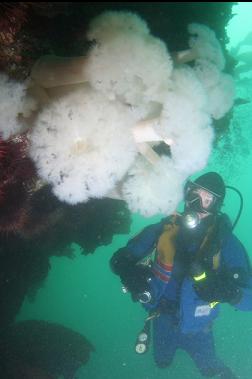
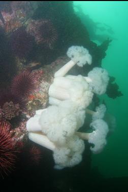
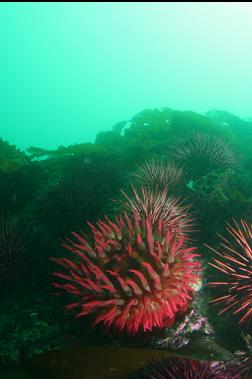
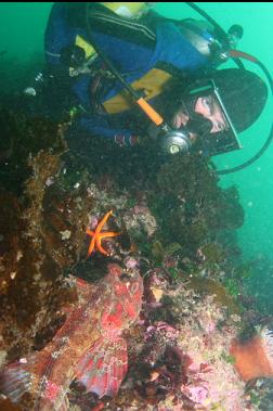
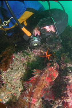
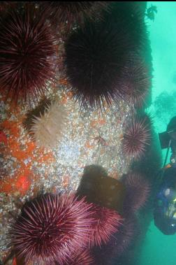
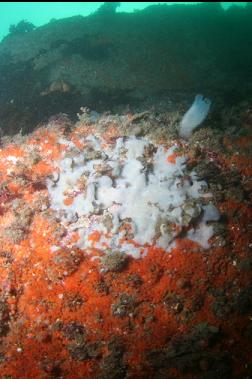
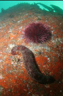
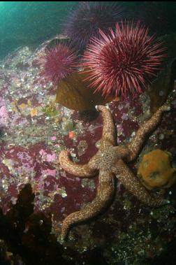
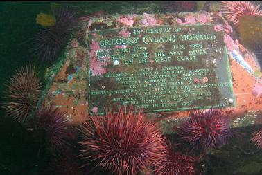
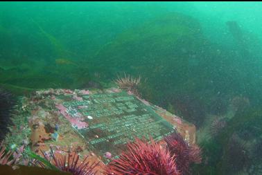
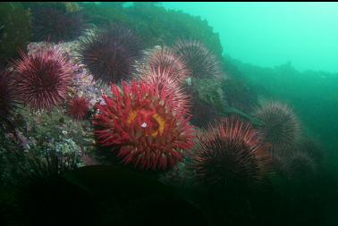
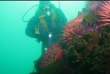
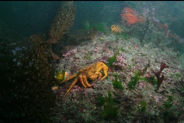
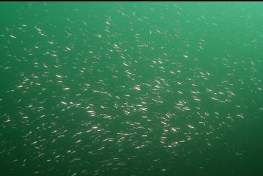
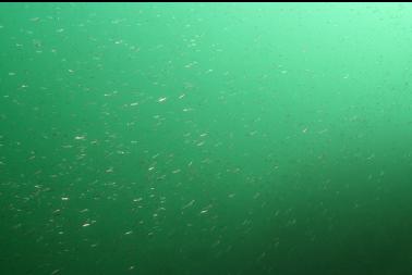
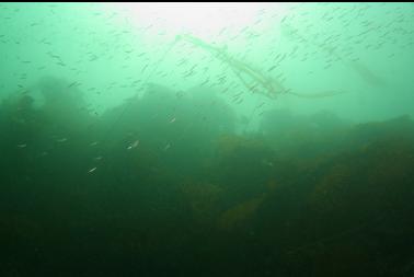
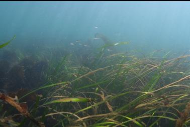
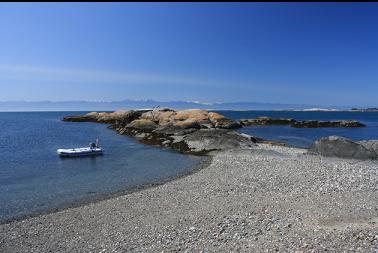
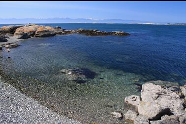
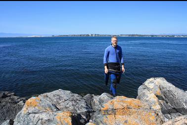
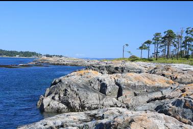
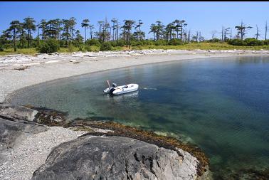
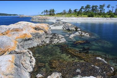
Heritage Point is on the South West tip of the Chatham Islands in the Oak Bay area. It sticks out into Plumper Passage, which can see up to 5 knots of current according to the chart. The chart also shows a somewhat-steep slope to about 50-60 feet deep. Trying to predict the slack times for the current was a bit confusing. The Baynes Channel correction (Race Passage-15 minutes) seemed the most logical to me since Baynes Channel is basically a continuation of Plumper Passage. The Tide View program however, showed slack about 2-3 hours earlier. I decided to go with the official Canadian Hydrographic Service Baynes Channel correction since I've had good luck with that at nearby Ten Mile Point. I went out on a calm, sunny day (June 30, 2009) from the Cattle Point boat launch. This launch is free and there's no traffic jam of boaters or "ramp rage" like you get at the more popular ramps. The Chatham Islands are owned by the Songhees Band, so are private property. I don't know what their policy is on visiting boaters so I didn't beach my boat, but anchored it a few feet deep and didn't walk above the high tide line. Apparently, according to a local kayaking guide, the band used to allow people to visit the islands, but then there were a few wildfires set by careless visitors so now people aren't allowed to hike around. Heritage Point is a rocky neck with tropical-looking beaches on each side. I anchored in the larger, protected bay on the East Side, walked across the pebbles to the West side and swam down along the point. Visibility was around 15-20 feet. I was suprised that there was hardly any bull kelp. There was a staircase of small walls with large, sandy ledges in between. It seemed like I'd found the bottom, when another small wall would step down in the distance. I made it down to about 55 feet, where it seemed like the rocky parts ended. I was a bit disappointed by the marine life. In such a current-swept area, I was expecting piles of colourful invertebrates (sort of like 10-Mile Point), but there were just slightly-silty rocks covered with urchins. When I looked closely, many of the rocky areas seemed to be coated with colonies of tube worms (cemented?). There was one cluster of plumose anemones. I saw a few buffalo sculpins and an Irish Lord. Other fish included copper, black and yellowtail rockfish (but just a few of each), and small lingcod. When I looked up, I could usually see a school of small herring and one time, I saw a school of silvery, long, eel-like fish (maybe sandlance?). I could feel some current during most of the dive, but in some areas, it was too strong to swim against and I had to hold onto the rocks and pull myself around the next corner where it was more manageable. I even saw a large urchin tumbling along the bottom in the flow. About 50 feet deep I came across a memorial plaque to a diver who died in 1996. I don't know if he was lost here or if it was one of his favorite dive areas. I've never heard of anyone diving here before so this was a surprise. It was nice to see that the plaque was still in good shape after over 10 years. I swam back from the tip of the point and saw a short section of wall about 40 feet deep covered with orange colonial and other kinds of tunicates. Back in the eel-grass carpeted shallows, I saw a school of small fish that looked like juvenile Pacific cod or pollock. I don't think I'll dive here again. The hassle of the current isn't worth the payoff in my opinion. It's still a beautiful place on the surface though.