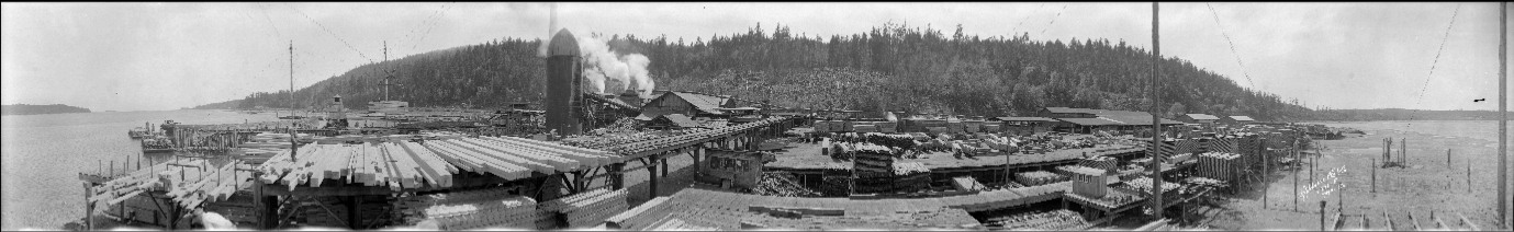
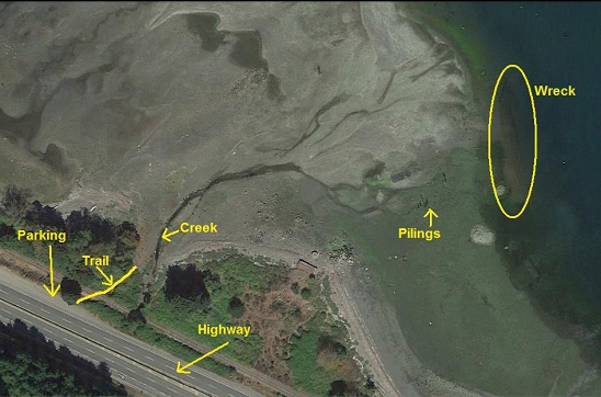
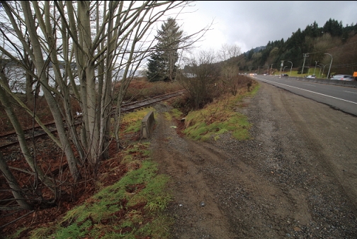
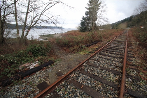
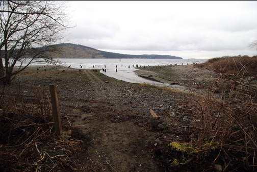
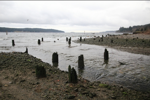
Red Gap was a town on the South Shore of Nanoose Harbour founded in the early 20th century and named after the popular 1915 novel "Ruggles of Red Gap". For most of its history it was the site of the Straits Lumber Company mill. At its peak in the 1930's it was the biggest mill in the Pacific Northwest. Its main customer was Japan. After Pearl Harbour, the customer became the enemy and the mill almost immediately went out of business. The mill was mostly demolished and burned in 1942. Today, Red Gap is often called a ghost town, but if there are still any remains of buildings, I haven't seen them. The site is now cut through by the highway. The only signs of the mill are a few pilings sticking out of the water in the bay and a few concrete dock foundations on the beach.
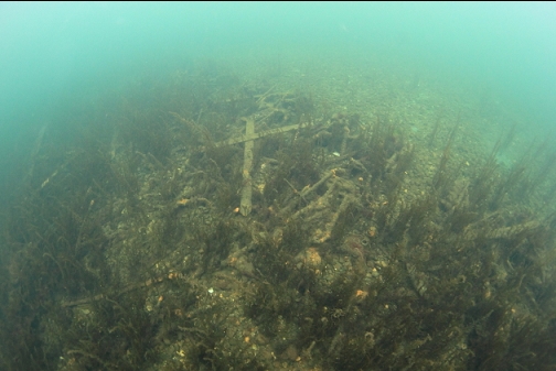
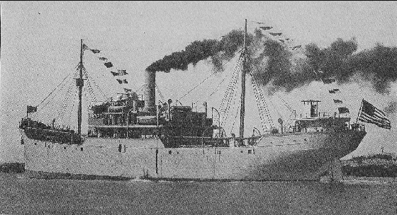
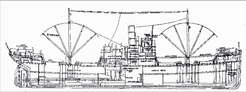
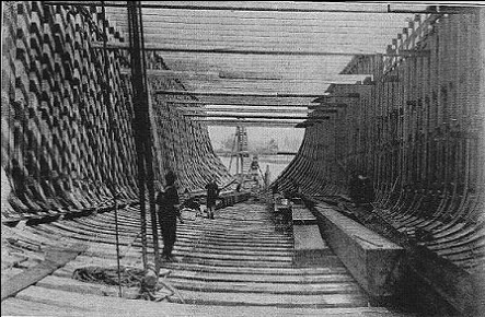
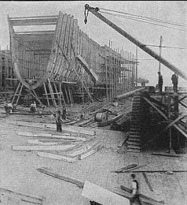
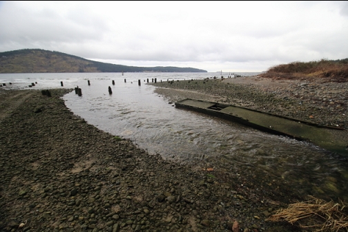
The reason I wanted to dive here was to see the remains of the wreck of the Hartlock which was a wooden Ferris-type freighter sunk as a breakwater in 1934. The Ferris ships were 281'-long wooden freighters designed by New York naval architect Theodore Ferris. When the US entered WW1, they needed a fleet of merchant ships able to withstand the German U-boat threat. The idea was to build a fleet of up to 1000 wooden, steam-powered freighters that could be assembled and sent to sea faster than the submarines could sink them. Most of these ships were built according to Ferris' plans, which is why they are known as Ferris ships. These were some of the largest wooden ships ever built. There were several larger wooden ships built previously, but most of them used iron frames and other structural members to give them extra rigidity. Except for the metal fasteners, the Ferris ships were built entirely of wood (pine in Eastern and Southern US and Douglas Fir in the West). Even back then, the idea was controversial and the design was considered old-fashioned. The construction of these ships was slowed by shortages of lumber and the lack of skilled workers. The war ended before many ships were built. In 1918, there were hundreds of just-completed ships and half-finished hulls. Some were used to ship cargos for a few years, but by the 1920's many were converted to barges or sunk as breakwaters. Over 200 were burned for the scrap value of the iron fasteners. The Hartlock was one of the ships completed after the war. According to the Nauticapedia.ca webpage, it was launched in 1919 and was originally called the Endymion. In 1929 in was converted to a log barge and in 1934 it was sold to the Straits Lumber Co. (that owned the mill in Red Gap) and sunk as a breakwater at the mill.
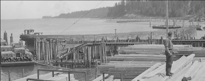
This is a crop from the photo (taken in 1935) at the top of this page. I think it shows
the hull of the converted-to-a-barge Hartlock in place as a breakwater:
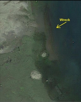
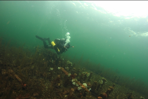
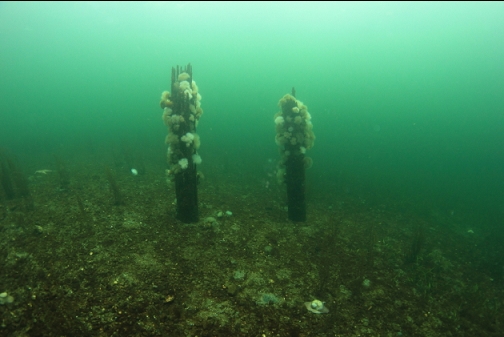
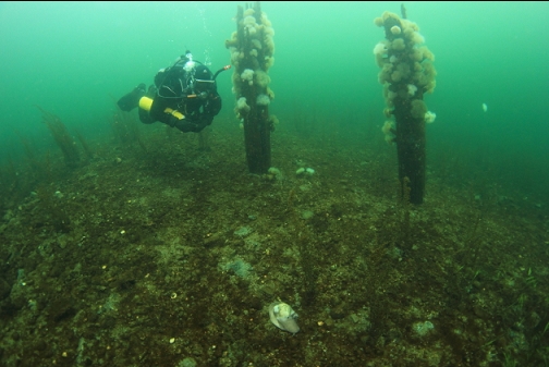
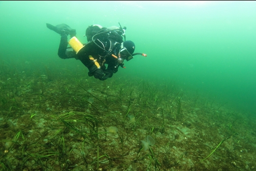
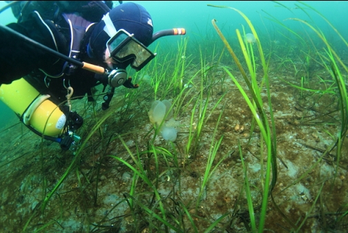
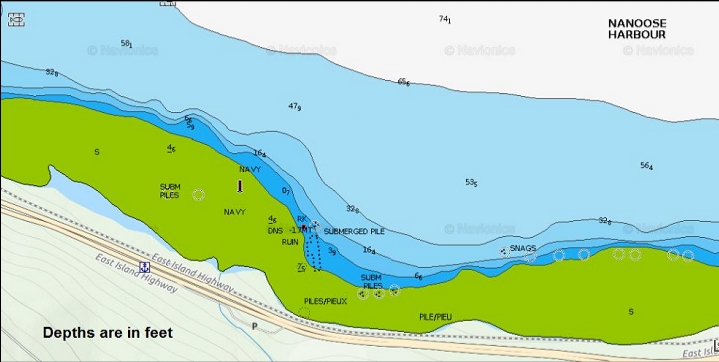
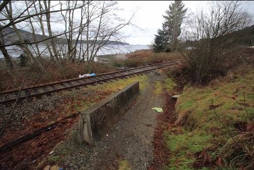
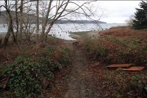
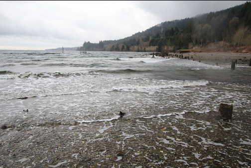
The Underwater Archaeological Society of B.C. has been diving here on the wreck a few years ago. I heard about this wreck in one of their newsletters. I realize that this is a very shallow dive and there isn't much left of the wreck, but I wanted to have a look before the good visibility of winter was over so I drove up here on Feb. 19, 2017. The site of the old mill is marked by some pilings in the shallow water that are visible from the highway. I parked next to the highway and walked down a short trail across some railroad tracks to the beach. This was at a spot where a small creek ran into the bay. I could see some pilings about 150 meters off in the distance to my right. On a satellite image, the wreck is visible under the shallow water just on the other side of these pilings. I showed up at high tide (the Nanaimo tide table was showing a 12' high tide) to make sure there was enough water to actually swim in.
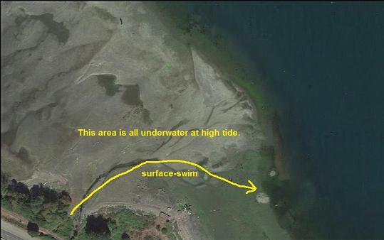
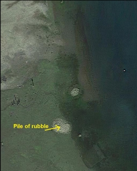
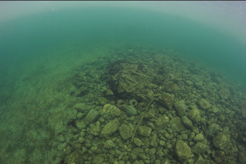
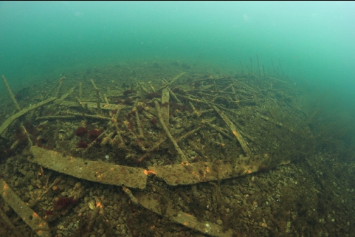
I snorkeled out on the surface to just past the far pilings. I saw a pile of rubble (rocks and pieces of metal) on the bottom near where the ship was and I descended there.
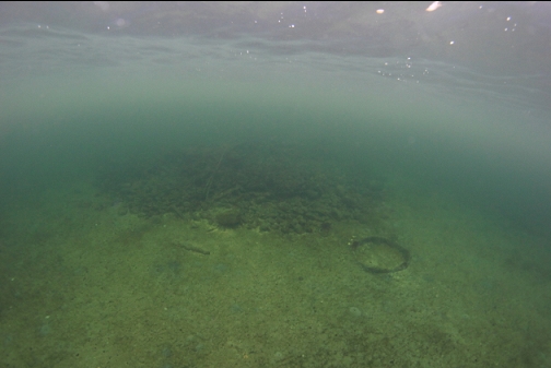
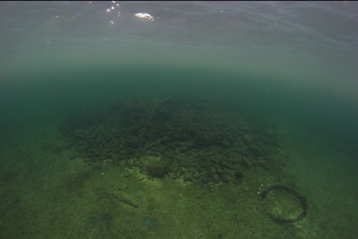
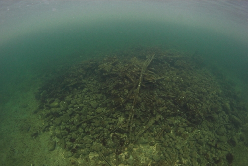
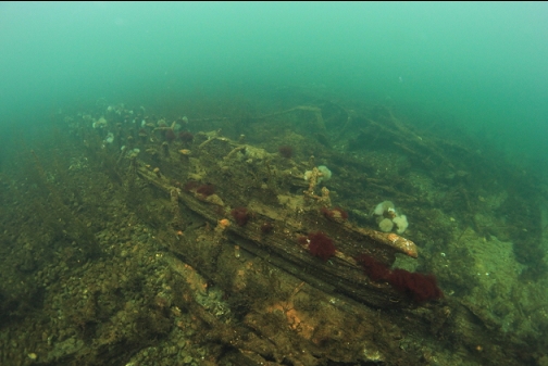
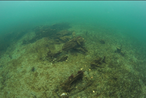
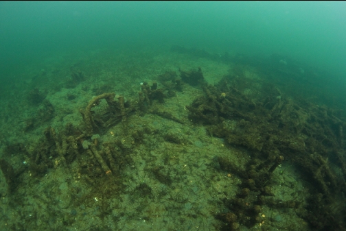
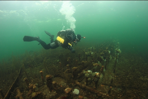
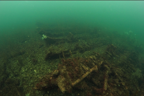
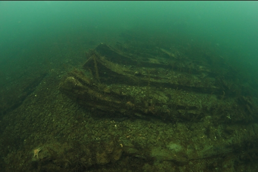
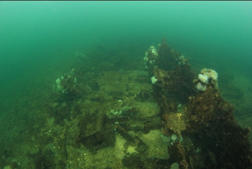
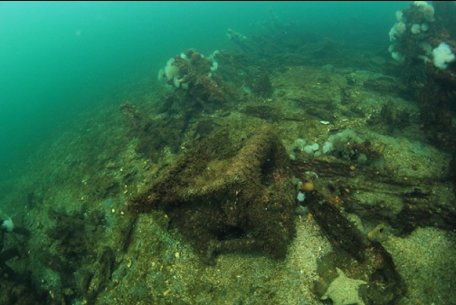
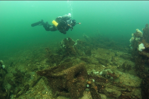
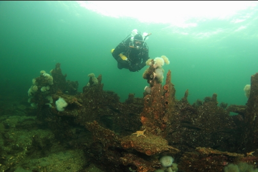
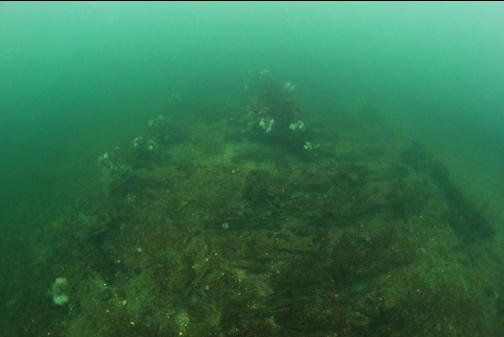
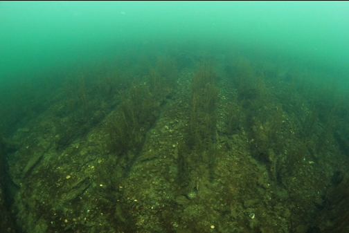
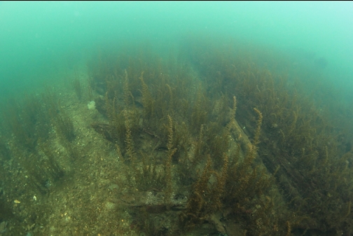
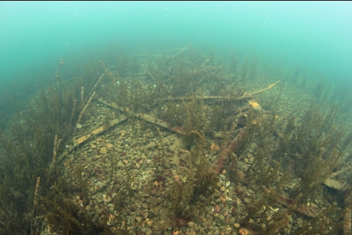
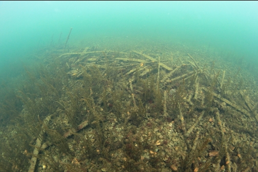
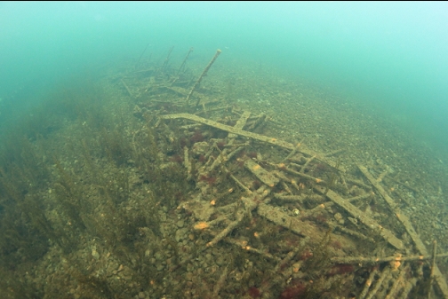
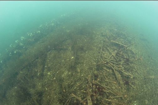
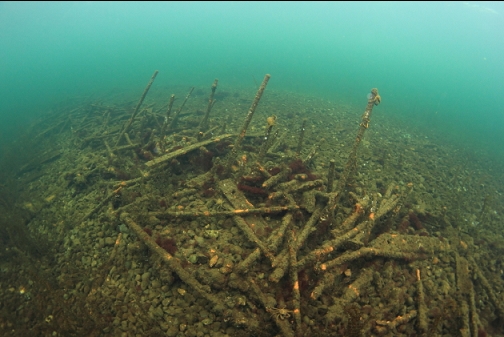
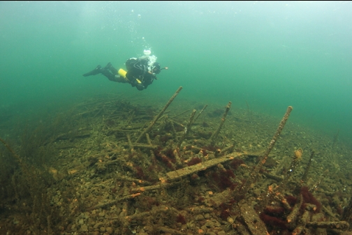
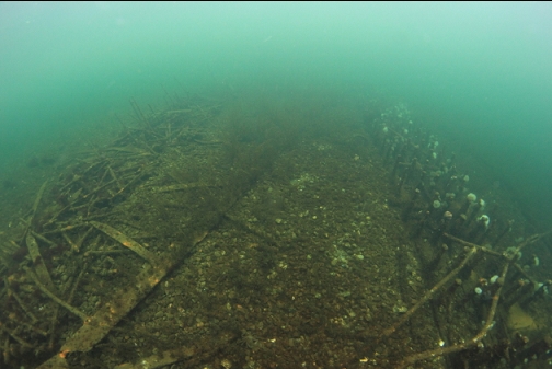
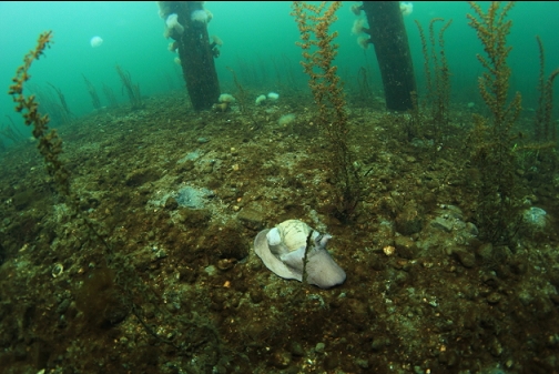
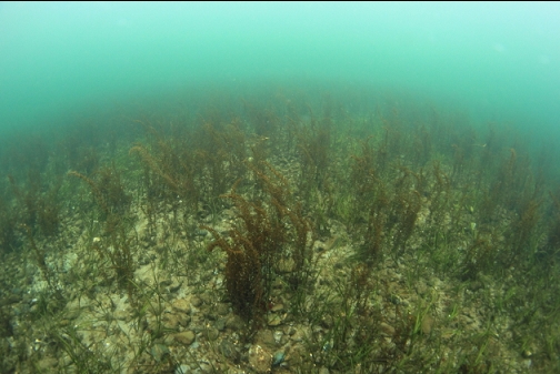
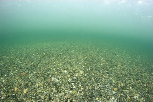
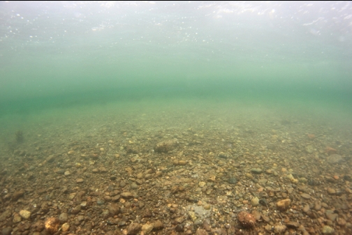
The wreck was only about 50' away from the rubble pile. Visibility was 30-40' and I saw the wreck almost right away. The area I first saw must have been the bow. There were rotting wooden beams and iron bolts sticking out of the sandy bottom. The depth here was 10-15'.
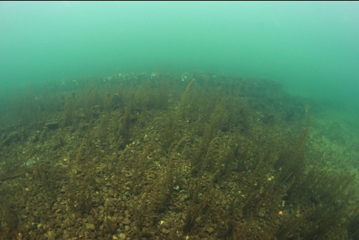
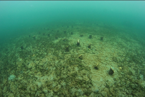
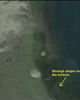
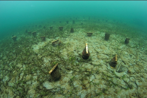
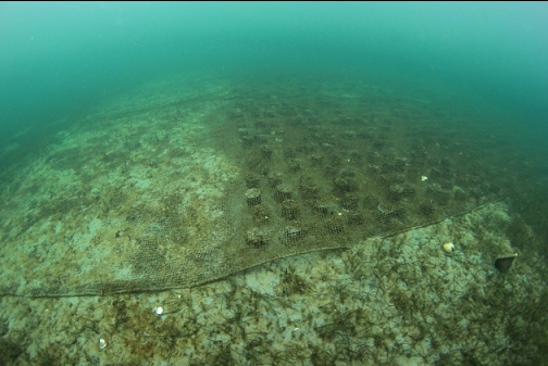
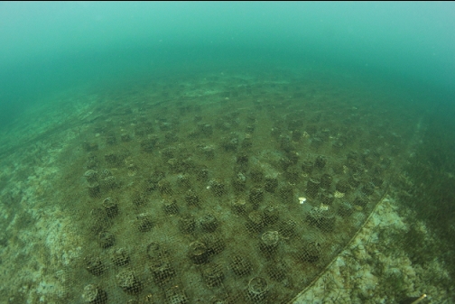
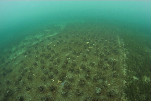
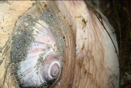
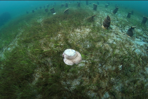
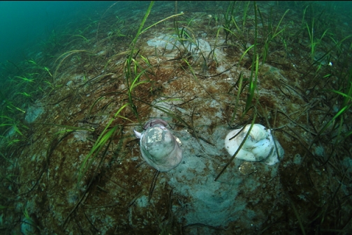
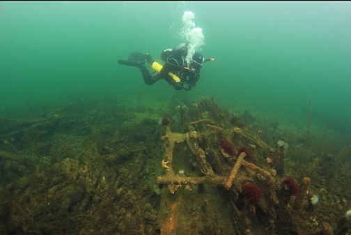
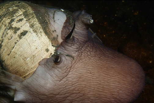
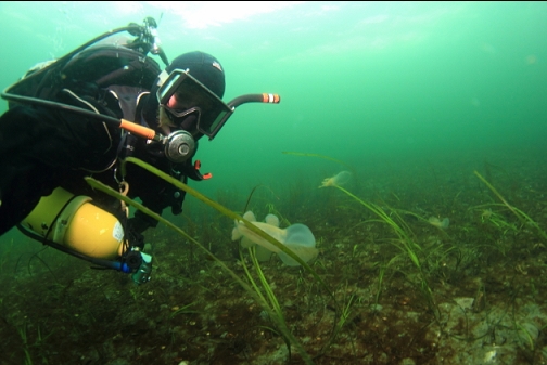
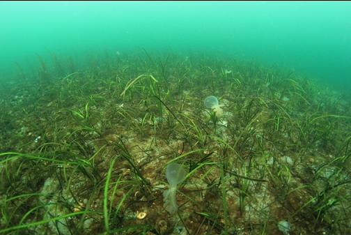
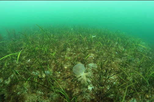
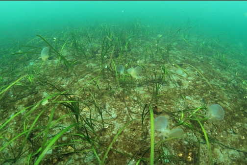
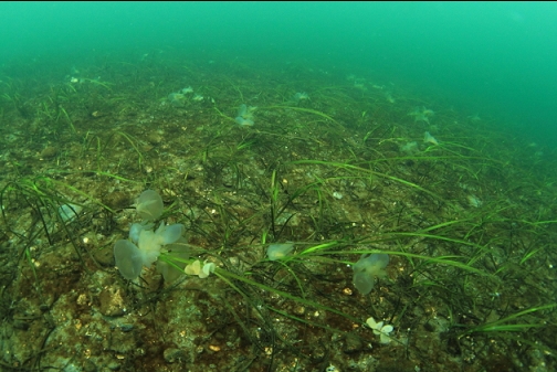
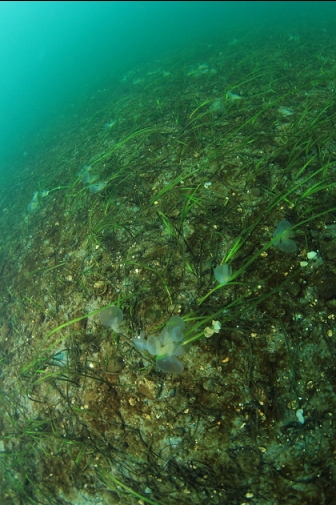
Before carrying on along the wreck I wanted to investigate a strange shape that I saw on the satellite image between the wreck and shore. I swam out from the wreck until I reached it. It was an aquaculture setup (I'm guessing for clams) with lots of sand-filled small mesh containers. A large net covered most of them. There were also lots of moon snails in the eelgrass nearby.
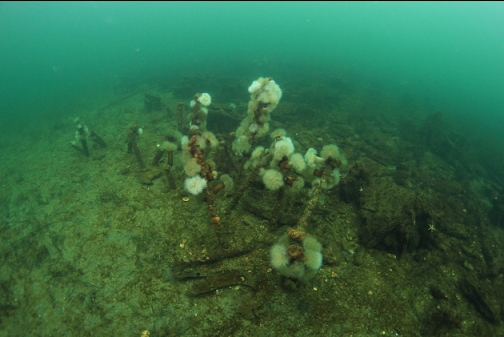
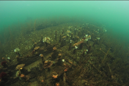
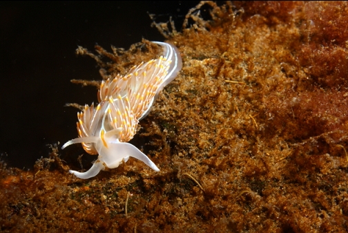
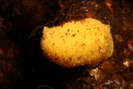
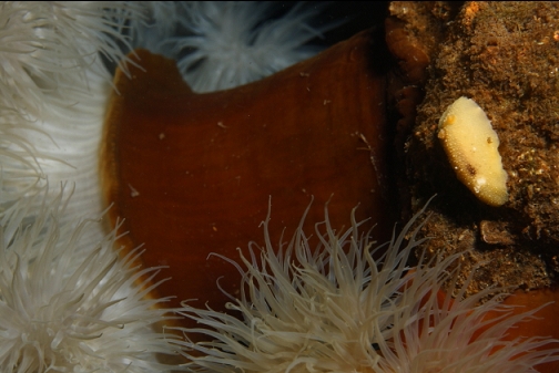
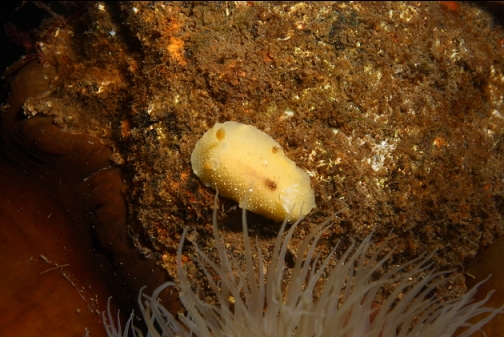
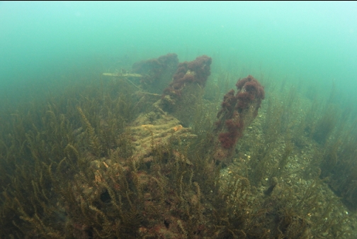
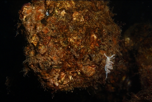
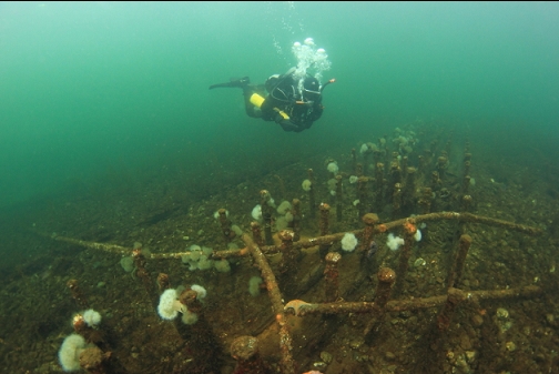
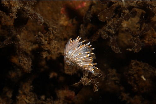
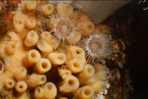
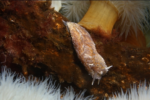
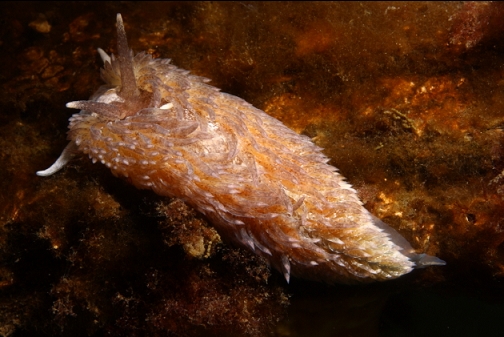
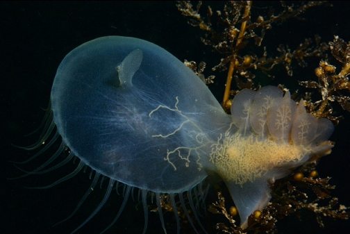
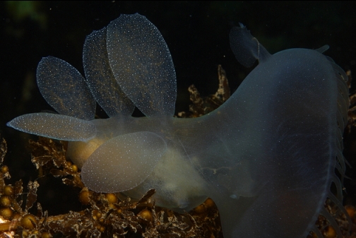
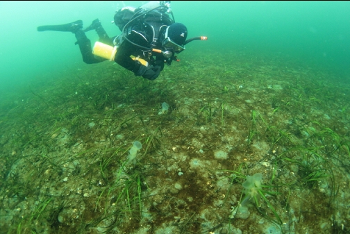
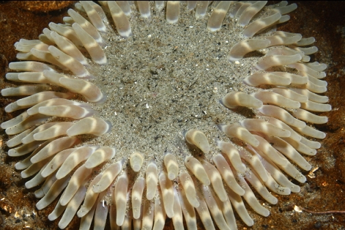
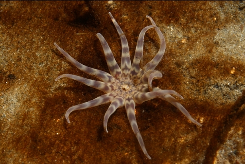
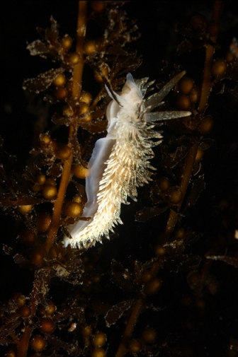
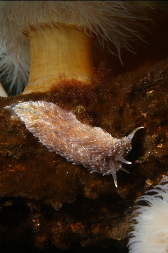
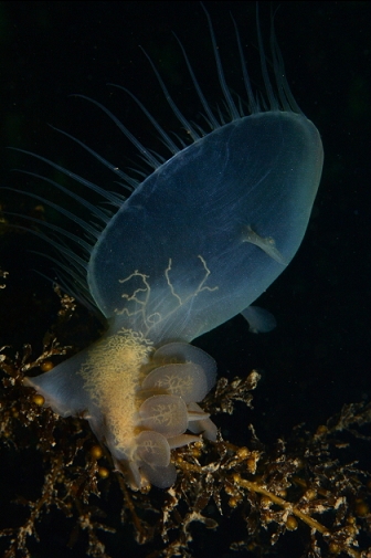
I swam back to the wreck and swam along it towards the stern. I was surprised that there was still a bit of wood left after almost 100 years. There were some plumose anemones, nudibranchs and kelp crabs. There were almost no fish. I think I saw a kelp greenling and a goby. The port side of the wreck was 15' deep and the starboard side was 10' deep. This was at high tide. At very low tides, a good portion of the wreckage probably sticks out of the water.
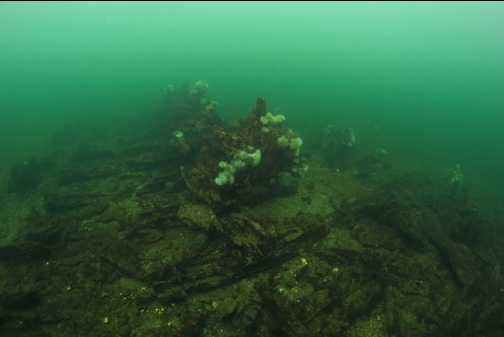
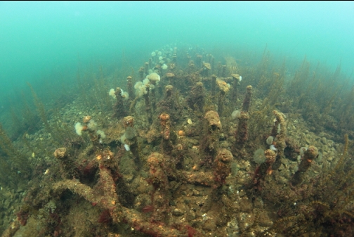
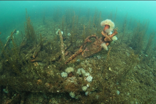
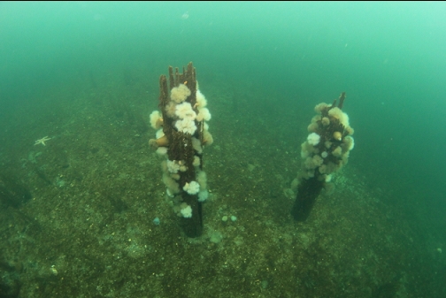
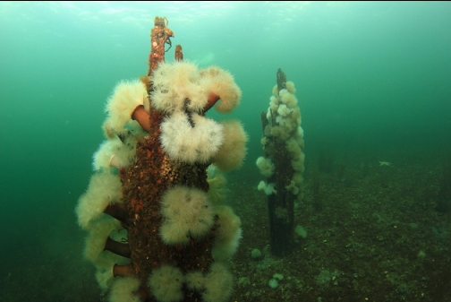
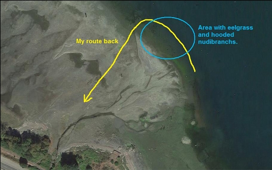
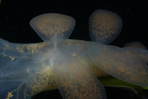
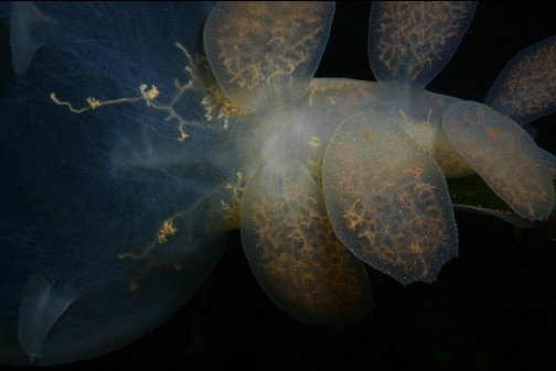
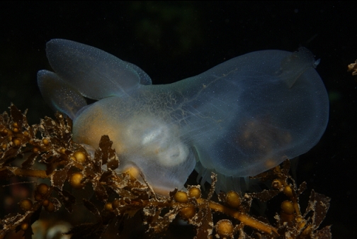
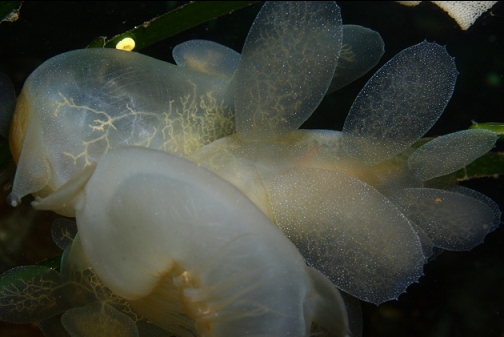
Near the stern of the wreck there were 2 stumps of pilings with some nudibranchs and plumose anemones on them. I swam back to shore on a wide arc, following the bottom of a shallow slope. The bottom here was around 15-19' deep. There was an eel grass bed with lots of hooded nudibranchs. When I headed back over the shallows to shore, the tide had dropped and I had to wade back for the last bit in the 2'-deep water.
I wouldn't suggest that this could ever be a popular dive spot for most divers, but I wanted to do one dive here to see what was left of the wreck. The conditions today were ideal for me to do that, and now I don't think I'll have the urge to dive here again.